Types of navigation equipment used on modern ships. An overview
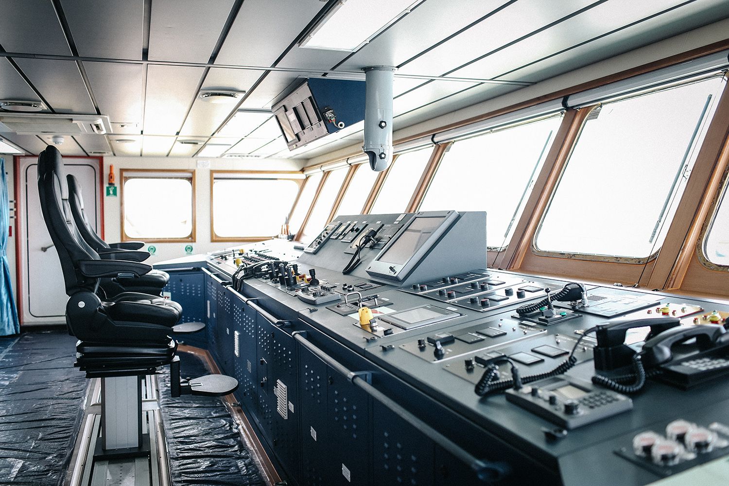
The navigation equipment of the vessel consists of a set of devices that determine the ship's position, speed, course, and also ensure safety during navigation in shallow waters or when meeting other vessels. Some of them have been used by seafarers for a long time, while others represent new technologies.
All bridge equipment should be regularly checked and tested. The list of the minimum shipborne navigational equipment depends on the tonnage of the vessel, its destination and date of construction. It is defined by SOLAS Chapter V, Regulation 19.
So, an overview of the navigation equipment used on merchant ships today.
Magnetic compass
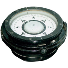
The oldest and most commonly used type of compass. In navigation, this tool is applied to determine the northern direction by the Earth's magnetic field.
Gyro compass
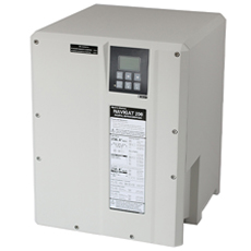
The gyro compass is the prime navigational device used on ships and submarines. Its principle of operation is based on the use of the properties of the gyroscope and the daily rotation of the Earth.
The gyro compass is superior to the magnetic one, because there can be no errors caused by magnetic fields: it finds the true North Pole of the Earth (navigationally more useful), while the magnetic compass finds the magnetic North Pole.
Rapid changes in course, speed or latitude cause deviations in the measurements after which the gyro adjusts itself. Most modern ships have satellite navigation systems (such as GPS) or other navigation tools that transmit data to the built-in gyro compass computer for correction.
ECDIS
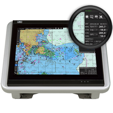
ECDIS (Electronic Chart Display and Information System) is the pinnacle of modern navigation computer technologies, a digital alternative to paper nautical charts.
The system is connected to other navigational equipment on ship such as the GNSS (GPS), AIS, gyro compass, autopilot, speed log, radar/ARPA, NAVTEX, echo sounder and others. Based on the processed data, ECDIS displays maps and the location of the vessel, plots the route and monitors deviations from the planned route, calculates safe courses, warns the navigation officer about danger, keeps a ship's log and provides many other sophisticated navigation and safety functions. Thus, ECDIS significantly reduces the burden on the navigator, which frees up time for better monitoring of the surrounding circumstances and making informed decisions on ship management.
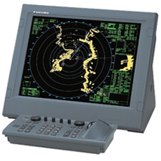
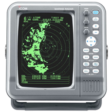
Radar
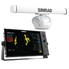
With the help of radar, any target around the vessel can be detected: ships, land obstacles, icebergs, etc. For this purpose, a rotating antenna is used. The picture of the ship’s surroundings is displayed on the device screen. This data can be used to avoid collisions and is especially useful in adverse weather conditions.
There are 2 types of radars used on ships: X-band and S-band radars. X-band radar operates at a frequency of about 10 GHz and with a wavelength of 3 cm (smaller antennas in weight and size). Being of higher frequency, this band provides a better target resolution.
The S-band radar operates at a frequency of 3 GHz with a wavelength of 10 cm (a larger antenna on the mast). This band is more resistant to interference than the X-band, and provides more accurate data during heavy rain or snow.
ARPA
ARPA (Automatic Radar Plotting Aid) is a computer system that processes radar data and creates tracks for vessels within the radar coverage of the ship.
Using advanced technologies, ARPA not only represents the current situation, but also predicts future situations. The system calculates the course of the tracked objects, their speed, time and distance necessary for safe passage with other vessels. If necessary, the user can get more detailed information on selected targets.
ATA
Like ARPA, the ATA (Automatic Tracking Aid) device displays information about the tracked target in graphical and numerical form using radar contacts. This allows the officer of the watch to plan a safer course without collisions.
Autopilot
At the time, this device made a technological breakthrough in maritime navigation.
Autopilot is a truly indispensable component of the bridge’s navigational equipment. This is a system (electronic or hydraulic) designed to automatically control the steering mechanism of a vessel and maintain it on a set course. By holding the steering in autopilot mode, the navigator can focus on other critical tasks such as collision risk assessment and avoidance.
The device is synchronized with the gyro compass. If the latter has any malfunctions, they will affect the steering of the vessel. In case of gyro compass failure, the system will lose the ability to control the vessel.
Modern autopilot systems can also be synchronized with ECDIS, which allows them to follow the route laid out on the electronic chart.
Autopilot cannot completely replace a human. The vessel must be operated manually when navigating in restricted waters and high-density traffic areas.
AIS
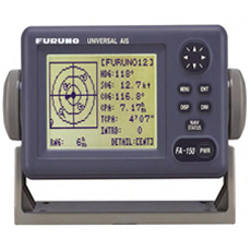
AIS (Automatic Identification System) is an automatic tracking system that serves to identify ships, their dimensions, course, speed, position and other data using VHF radio waves (frequencies 161.975 MHz and 162.025 MHz). Its main task is to reduce the risk of ship collisions.
Unlike radars, which are able to detect the appearance of large floating objects near the ship and approximately estimate their current direction and speed, AIS provides much more detailed and accurate information about the navigation situation. It is displayed on the screen of the AIS station or ECDIS.
Vessels equipped with AIS must constantly maintain it in operation. An exception is made in cases where international agreements provide for the protection of navigational information.
GPS receiver
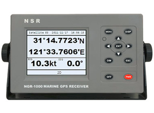
This type of navigation device relies on GPS (Global Positioning System) technology using satellites. It determines with a high degree of accuracy the coordinates of the vessel, its speed, course and time required to cover the distance between two given points.
GPS technology can also help avoid ship collisions and alert emergency services in the event of an accident.
Rudder angle indicator
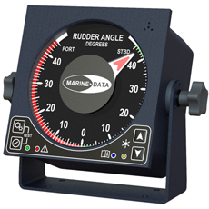
This instrument indicates the current position of the rudder blade. It is usually installed near the steering wheel, on the wings of the bridge and in the engine room.
Speed and Distance Log Device
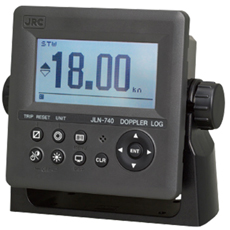
This navigation device measures the speed and distance passed by the vessel from a given point. It is used to calculate the expected time of the ship's entry into port. The data is transmitted to the port authorities.
GMDSS console
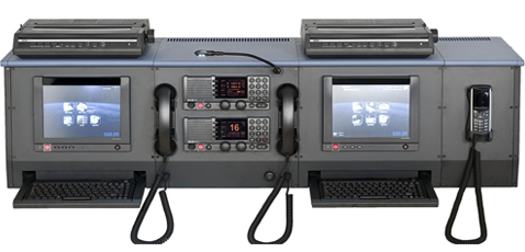
Global Maritime Distress and Safety System (GMDSS) uses Earth and satellite technologies, as well as ship radio systems. The components of this system on the ship are VHF, MF/HF with DSC, Navtex, radiotelex, SART, EPIRB, Inmarsat-C.
The GMDSS console is used to notify the coastal services of emergency situations with vessels, as well as to receive maritime safety messages and to communicate with other ships by radio.
VDR
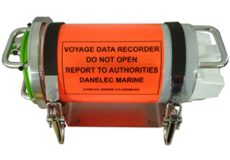
VDR (Voyage Data Recorder) is a device similar to a black box carried on aircraft. Extremely important navigation equipment that continuously records all the information necessary for further investigation in case of an accident on board.
There are different types of data loggers, but they all provide data for the last 12-24 hours prior to an emergency.
Echo sounder
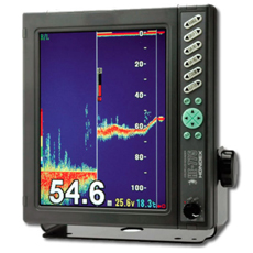
This device is more than 100 years old. It is used to measure the depth under the vessel by sending a sound pulse, which bounces off the bottom and returns back to the source.
Rate of turn indicator
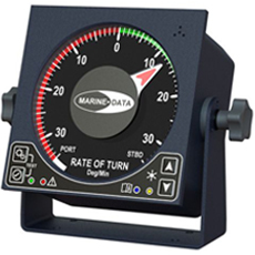
Rate of turn indicator (ROTI) shows the speed at which the ship turns at a fixed angle of rotation of the rudder. The turning speed is measured in degrees per minute.
There are two types of ROTIs: digital and analog.
The analog type of device is compulsory, it calculates the turning speed faster and more correctly, so it is still the most installed type on board ships. As for the digital type, it can be used as an analog type repeater.
ROTI is installed on the ship as an independent device integrated with the steering/autopilot.
LRIT
LRIT (Long Range Identification and Tracking) is an international vessel tracking and identification system established by the IMO. It is aimed at enhancing the security of shipping and ensuring the protection of the marine environment.
According to SOLAS Chapter V, Regulation 19.1, the following types of vessels are required to transmit information to the LRIT system during their international voyages:
-
passenger ships, including high-speed passenger craft;
-
cargo ships, including high-speed craft, of 300 gross tons and above, and
-
mobile offshore drilling units.
BNWAS
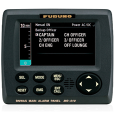
BNWAS (Bridge Navigation Watch and Alarm System) is another important automated system used on ships. The mechanism emits a nasty sound every 3, 9 or 12 minutes until the necessary button is pressed.
BNWAS thus warns the ship's captain or other boatmasters if the officer on watch does not respond and cannot perform his duties on the bridge. The consequences of this may be severe. Sometimes even 5 minutes is enough for an accident to occur with a vessel left unattended.
This system shall always be in operation and may be deactivated by the master of the ship only if he deems it necessary.
Sound reception system
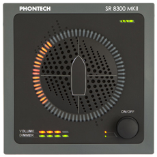
This acoustic system is necessary on ships with a fully enclosed bridge. It allows the navigating officer inside the cabin to hear external signals of ships, coastal stations and other objects.
The device is built into the navigation console and helps the officer to keep watch according to the rules of COLREGs (Convention on the International Regulations for Preventing Collisions at Sea).
Ship whistle
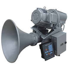
This device is also called a typhon, a horn or a foghorn. The ship's whistle is used in difficult navigation situations, such as poor visibility, heavy traffic, etc. It also helps to warn the crew and other vessels nearby about an emergency on board.
The ship's horn is usually duplicated. One works under air pressure, and the other is powered by electricity. They should be operated both manually and electrically from the bridge.
Daylight signalling lamp, or ALDIS lamp
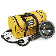
In addition to the sound signals, there are also warning lights for emergency situations, which can also be used at night. Like other ship emergency equipment, the lamp can be powered not only from the ship's main electrical system, but also from emergency batteries.
Navigation lights

All vessels, both small and large, are required to have identification lights that give information about their type, size and moving direction. Nav lights are used to prevent collisions with other vessels at night or during periods of reduced visibility.
Maritime signal flags

Signal flags have been used in navigation since ancient times. At present, 4 dozen flags are used, each of them has its own meaning. They are described in the International Code of Signals. For example, a flag with the letter equivalent "B/Bravo" means "I am taking in or discharging or carrying dangerous goods", while a flag with the letters "L/Lima" means "You should stop your vessel immediately", etc.
***
These are the main types of navigation equipment of modern ships. Thanks to the advanced technologies used, navigation has become more efficient and safe than ever before.
By Olga Davydova and Julia Zhyvotova
It may be interesting:
Global Maritime Distress and Safety System
GMDSS equipment carriage requirements
Shipborne Automatic Identification System (AIS)
Communication Systems in the Maritime Industry


Nice article